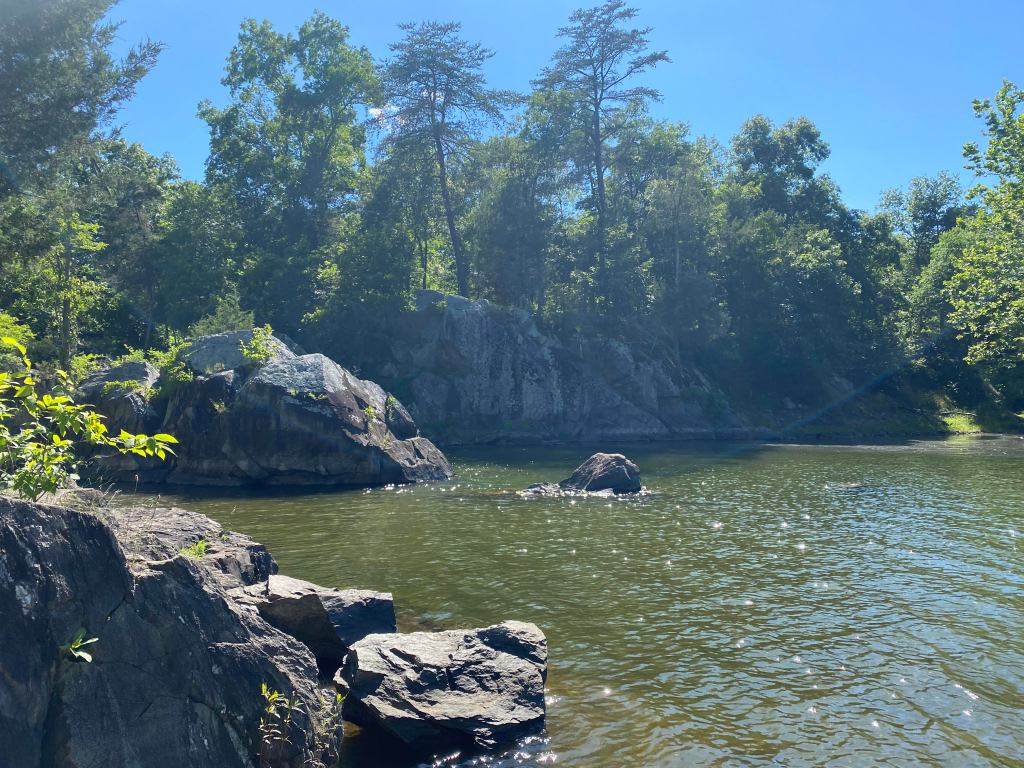
On the occasional Saturday morning after the less-occasional long week, I find myself eating breakfast while sitting on a rock ledge that overlooks a small inlet off the C&O Canal trail. The inlet is just south of Great Falls National Park (on the Maryland side), and when the sun hits it just right, the blues of the water and sky, the greens of the trees and foliage, and the grays of the rocks all stand out in a way that even the newest iPhone camera can never truly catch.
The first time I rounded the bend that led me to this little enclave, I caught my breath—in the way that you do when you fall in love. And now, every time I need to get out of the city, I ride to that spot—that perfect little spot—that is, in a way, like a dear friend.
Like many DC residents, I do not have a car. Beyond the environmental impact of vehicles, the cost of the car, insurance, street parking permits, as well as the arduous task of finding parking in the District, dissuaded me. While I love living in this city, I also love leaving this city for camping and hiking trips. Although I knew DC was bordered by two rivers and home to at least two national parks (among many other neighborhood parks), I did not start exploring those places in earnest until this past year. What I have found is a wealth of beautiful outdoor space—many spaces like the one mentioned above—completely accessible sans-car.
There are a number of trails in and around DC, many of them paved, and several will take riders into Maryland or Virginia. The Rock Creek Park Trail, for example, will guide cyclists around the city safely and through Rock Creek Park. This trail and its spur trails are great for biking and hiking. Then, the Mount Vernon Trail reaches into Virginia and stops at Mount Vernon. It also passes by Reagan National Airport, but I have not quite figured out how to use my bike for airport transportation. (Once I do, you all will be the first to know, but for now the Metro will do.)
And then there is the C&O Canal. The C&O Canal and bordering trail starts just outside of Georgetown and runs 184 miles, ending in Cumberland, Maryland. The canal was built in 1828 and opened in 1830, operating until 1924. The canal system was originally used for canal boats carrying cargo, and the trail was originally used by the “canal mules” that towed the boats along the canal. Dotting the trail are the old lock houses where the lock attendants and their families lived. The trail and surrounding areas are now maintained by the National Parks System (NPS).
If the trail ever was glamorous, (and I doubt it ever was) it certainly is not now, though it possesses a charming, rugged beauty. The canal is now mostly bright green algae in the spots where its water levels have not completely dropped off. The trail is unpaved, although well-maintained by NPS rangers. It is lined with tall trees and runs between the canal and the Potomac, and subsequently, the Shenandoah rivers. The trail is always slightly cooler than the standing outdoor temperatures. It is, in other words, one of the best ways to immediately immerse yourself in a wild space outside of DC.

The C&O Trail goes past a number of trails, national, and state parks, and runs through various towns in West Virginia, Virginia, and Maryland. Fifteen miles outside of DC is Great Falls National Park, and 60 miles outside of DC is Harpers Ferry, a national historic park with restaurants, BnBs, and small shops settled in the middle of boating outposts, ziplining courses, and the Appalachian Trail. The flat 60 miles to Harpers Ferry can be an ambitious, but fun and colorful, bike-camping trip in the fall.
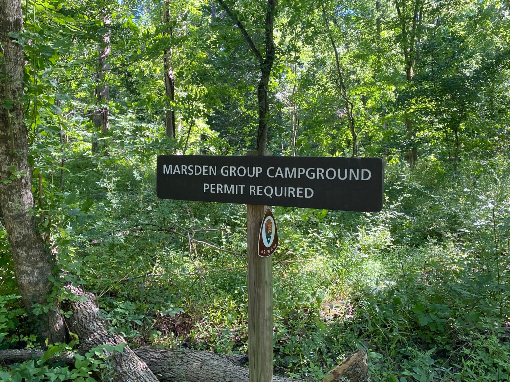
Besides being a walking, running, and cycling trail itself, the C&O Canal is dotted with hiking and climbing trails and campsites. While accessible by vehicle (for anyone looking to park and hike in), these areas are most easily accessed by cyclists and hikers, and they are set up to accommodate cyclists. The Marsden Group Campground, located about 12 miles outside of DC, includes picnic tables and bike racks, and costs $15 per night. The campground is also set off from the trail, and the head of the Billy Goat Trail sits at the back of the campground.
Further up the trail, there are several small campsites just off the path. While there is less privacy, the sites have picnic tables, water wells (with potable water) and port-o-potties. These campsites are free of charge and are available on a first-come-first-served basis–and this is only the first 60 miles of the trail.
The remaining 120 miles are also home to off-trail activities, campgrounds, towns, and breathtaking scenery. For anyone looking to explore parts of the trail or only ride certain lengths of the path, three different train lines run through towns along the trail: Amtrak, MARC’s Brunswick line, and the Capitol Limited line. Each has bike service and can offer reprieve from a long ride back home or to a new destination.
The trail along the Canal has been the same for more than 100 years, but the ride along the Canal is ever-changing, and it seems to only get better each Saturday morning.
